Coal Mine Canyon


Coal Mine Canyon is a branch of the Grand Canyon. The canyon gets its name from the from the fact that it was once mined for coal. The coal proved to be of poor quality, so the mining was abandoned.
It is located on the border between the Hopi and Navajo Reservations and a permit is required to visit the canyon, but it is not available from the Navajo Parks & Recreation office in Cameron as it used to be but at the elusive new Local Chapter… just getting the permit is an adventure in itself!

There are no road markers or signs pointing out the location of Coal Mine Canyon, and a person could easily travel through the deserted area without ever knowing it was there. 

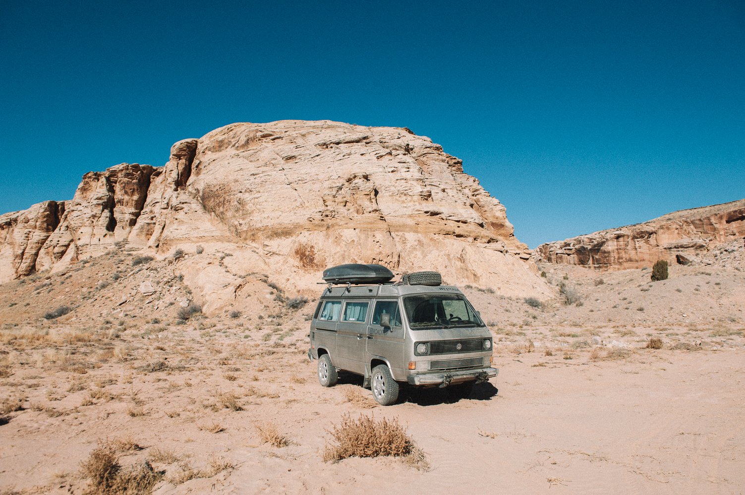
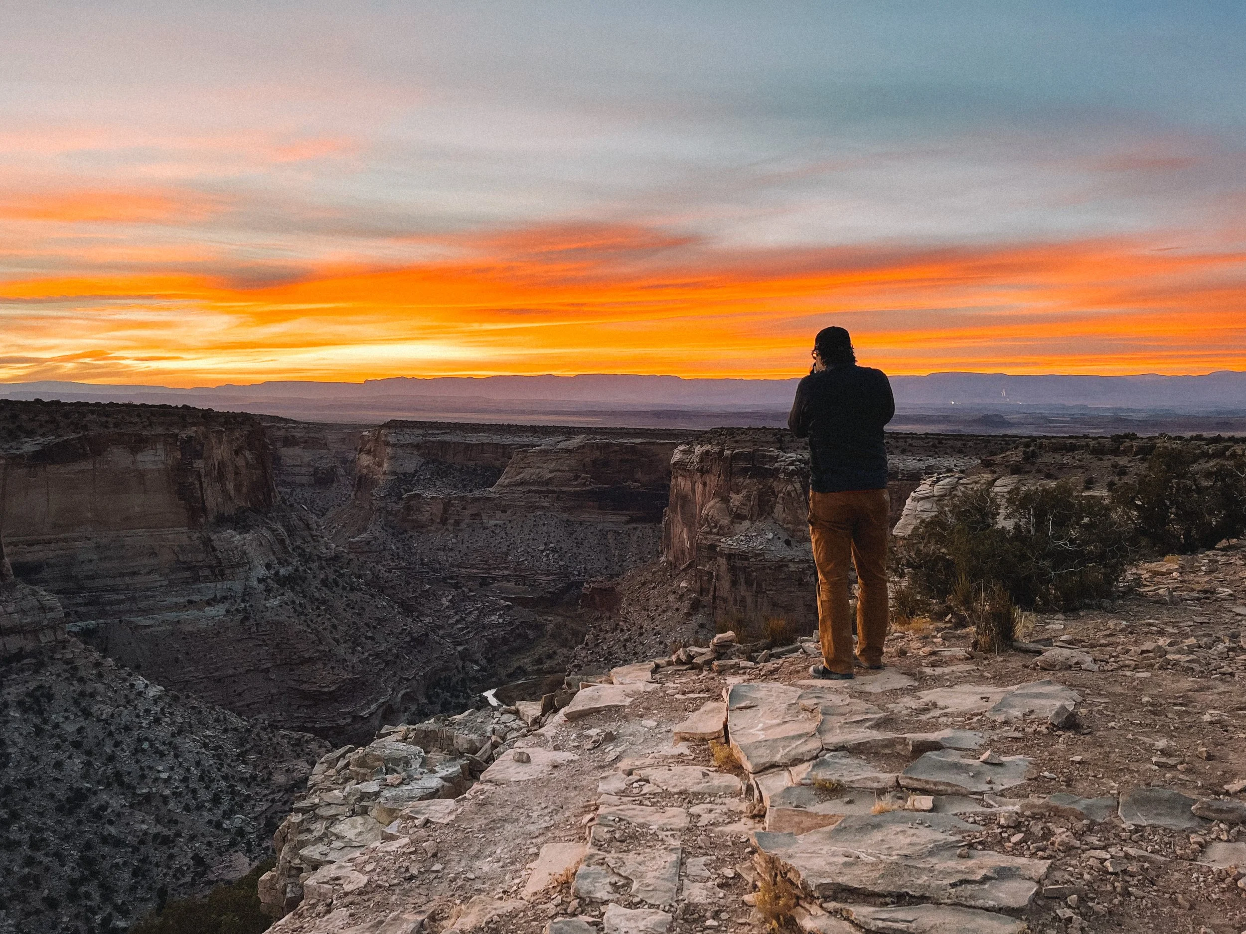
The Westy on the Rim

To plant this visit, we had to read old blog posts, use JF’s orienteering skills to map the points we wanted to see in advance, play phone tag to get a permit (that we ended up getting from a nice lady’s house at 8:30 pm on the reservation on Friday night…). This place will make you work for it, but this will only make it sweeter. 

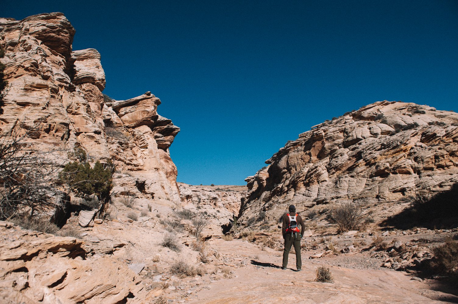
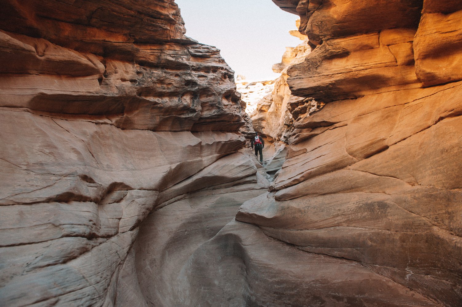
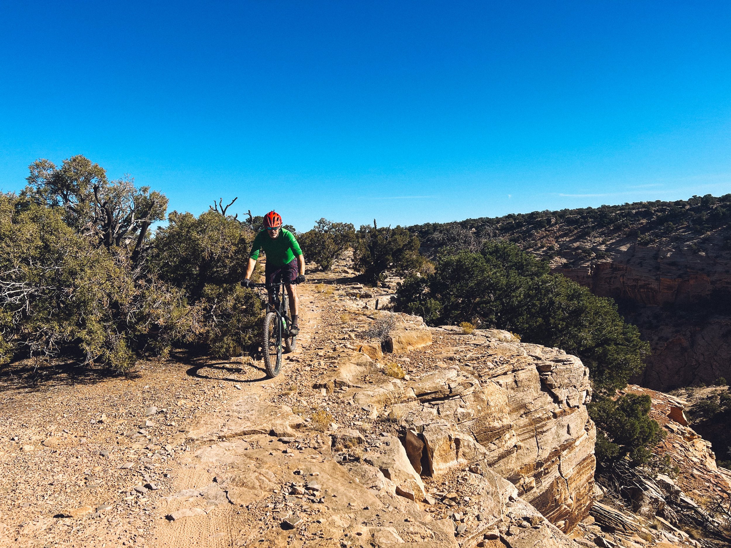
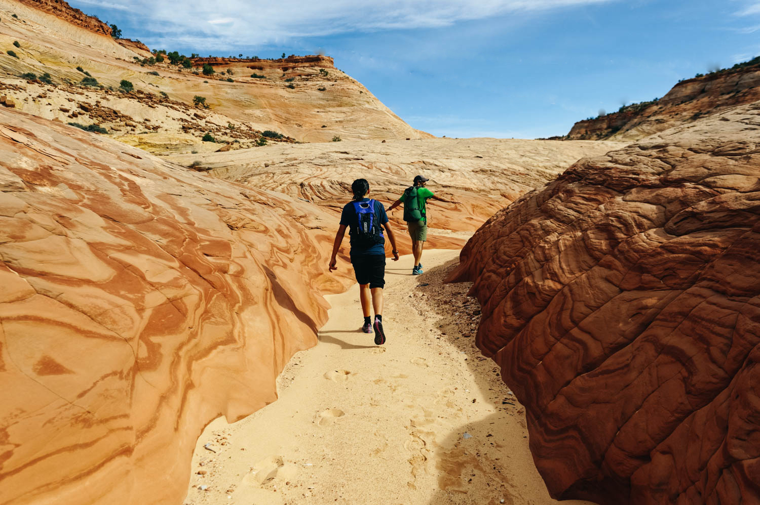
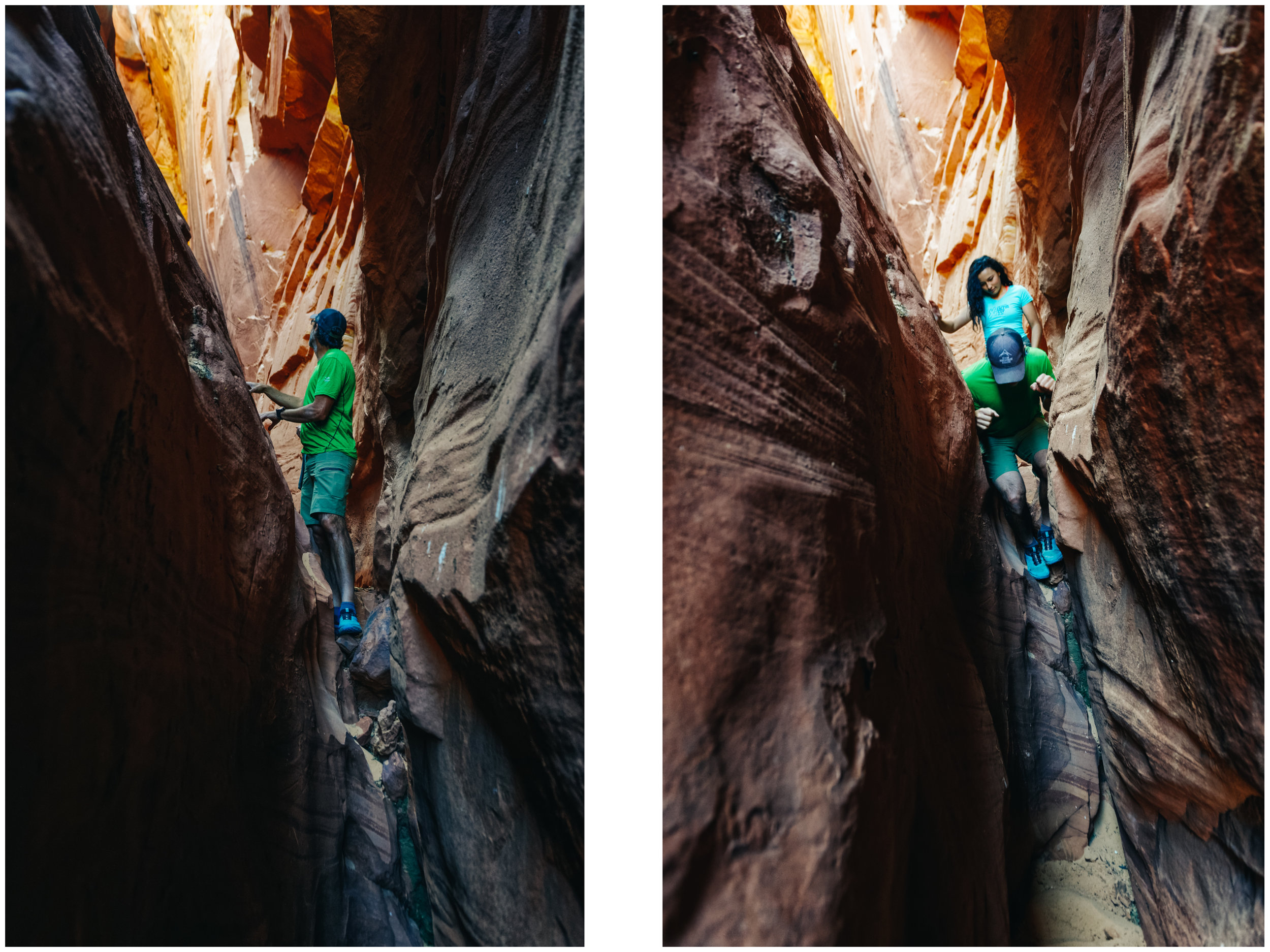
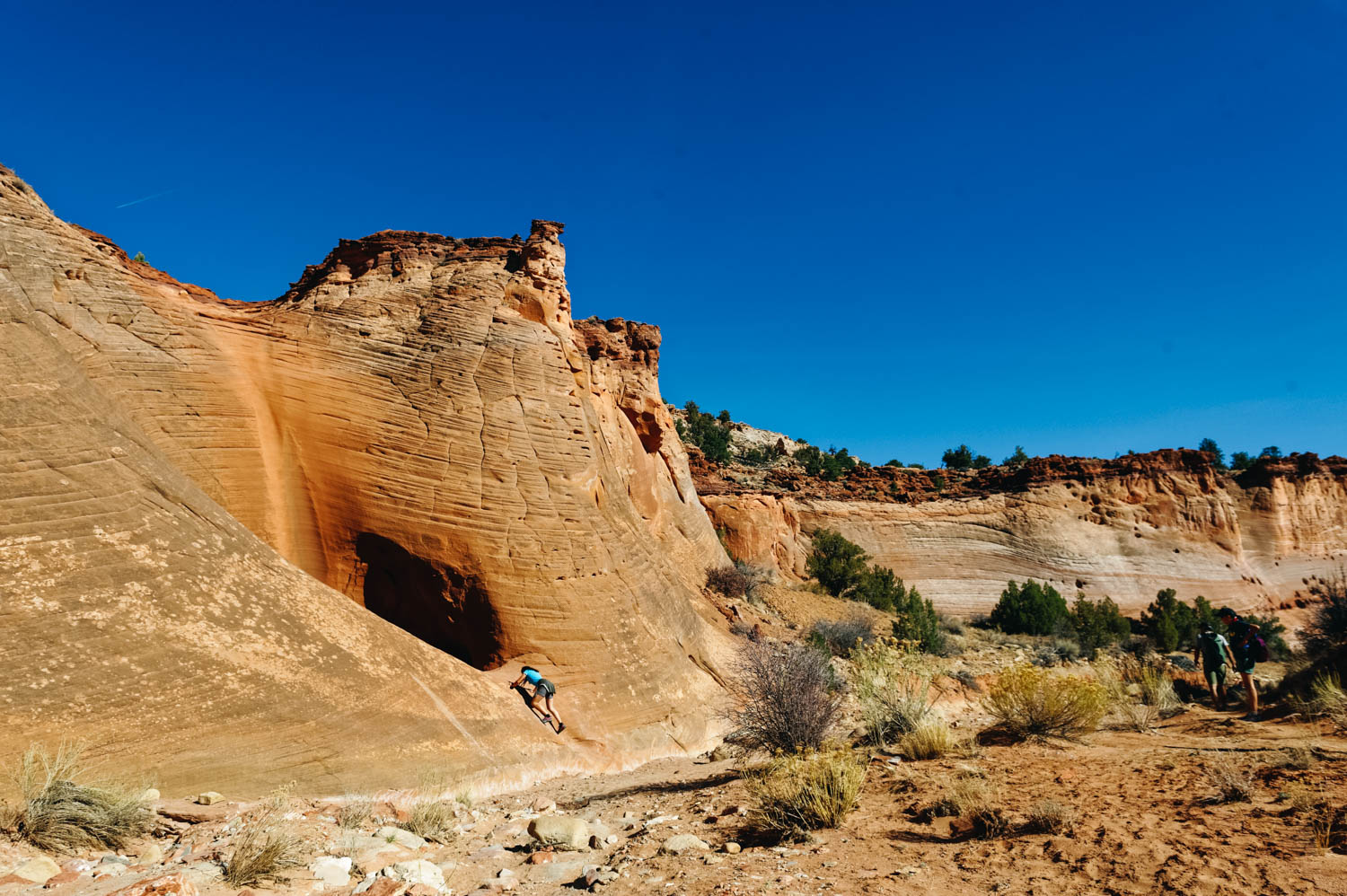
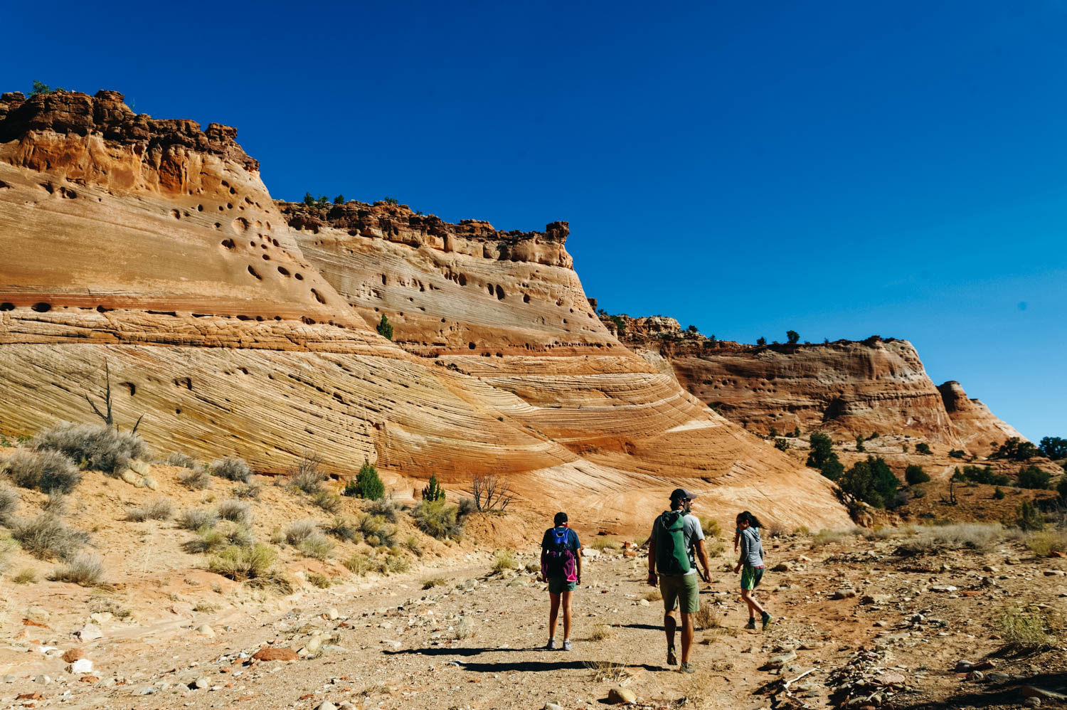
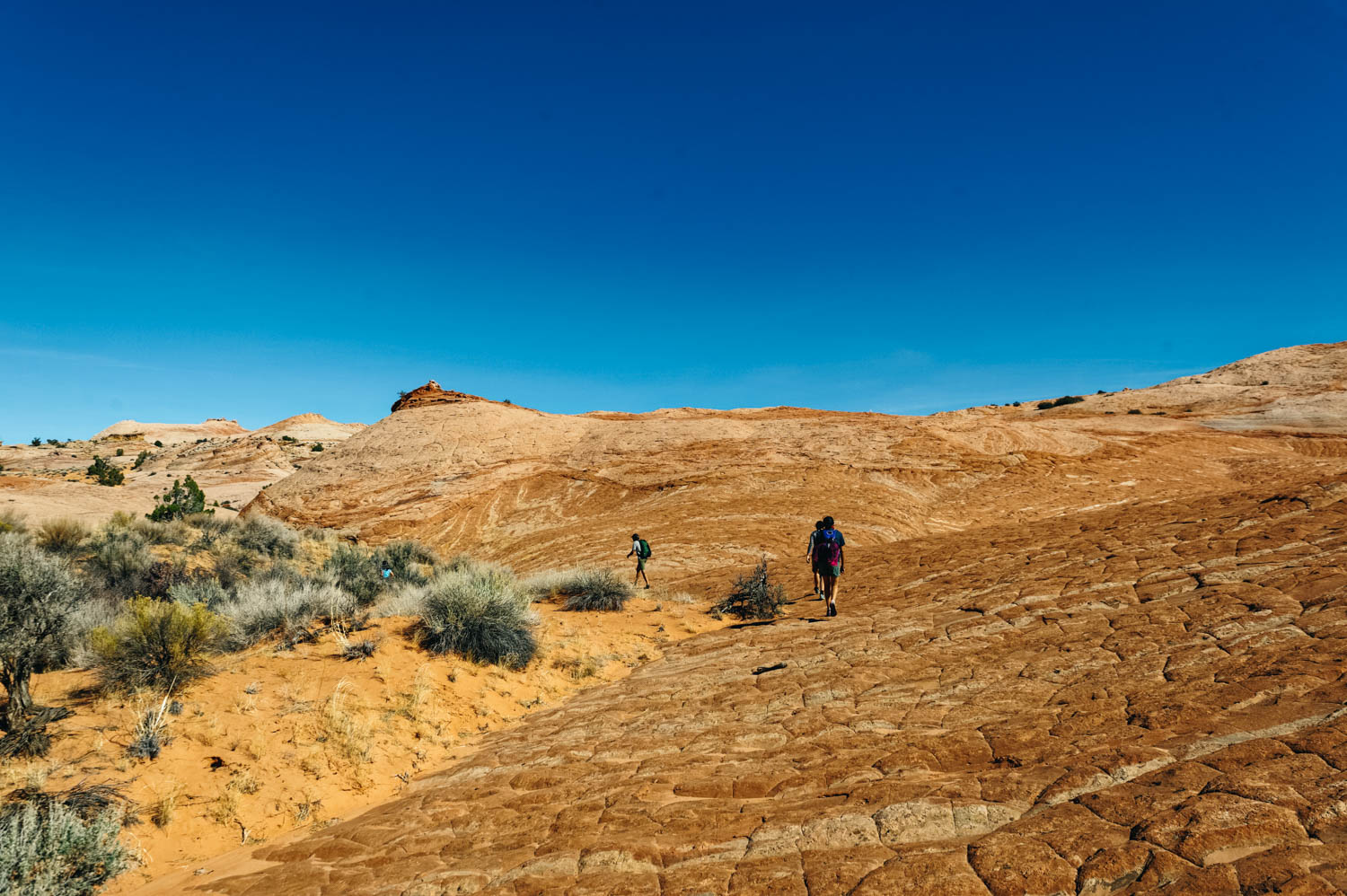
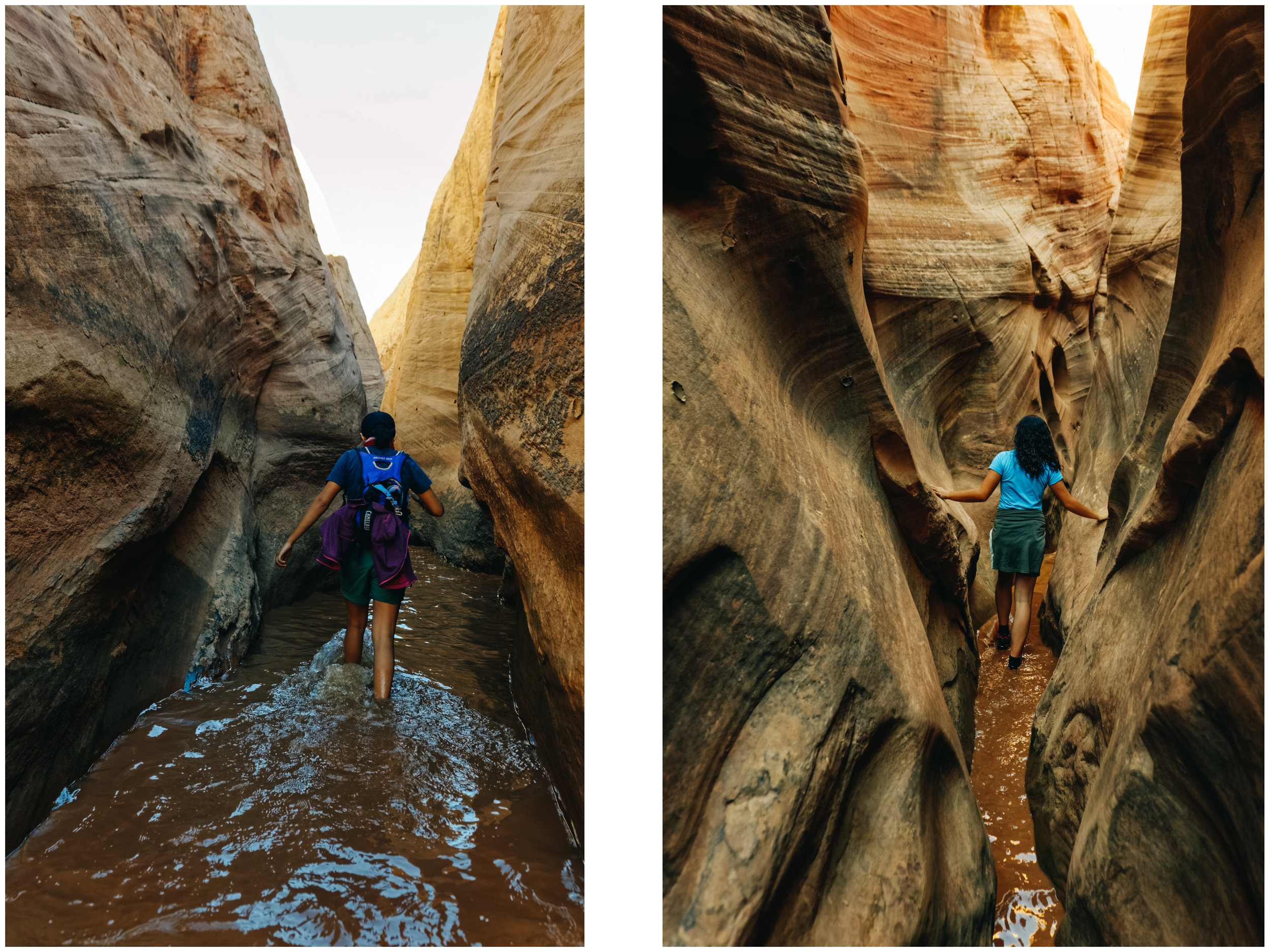
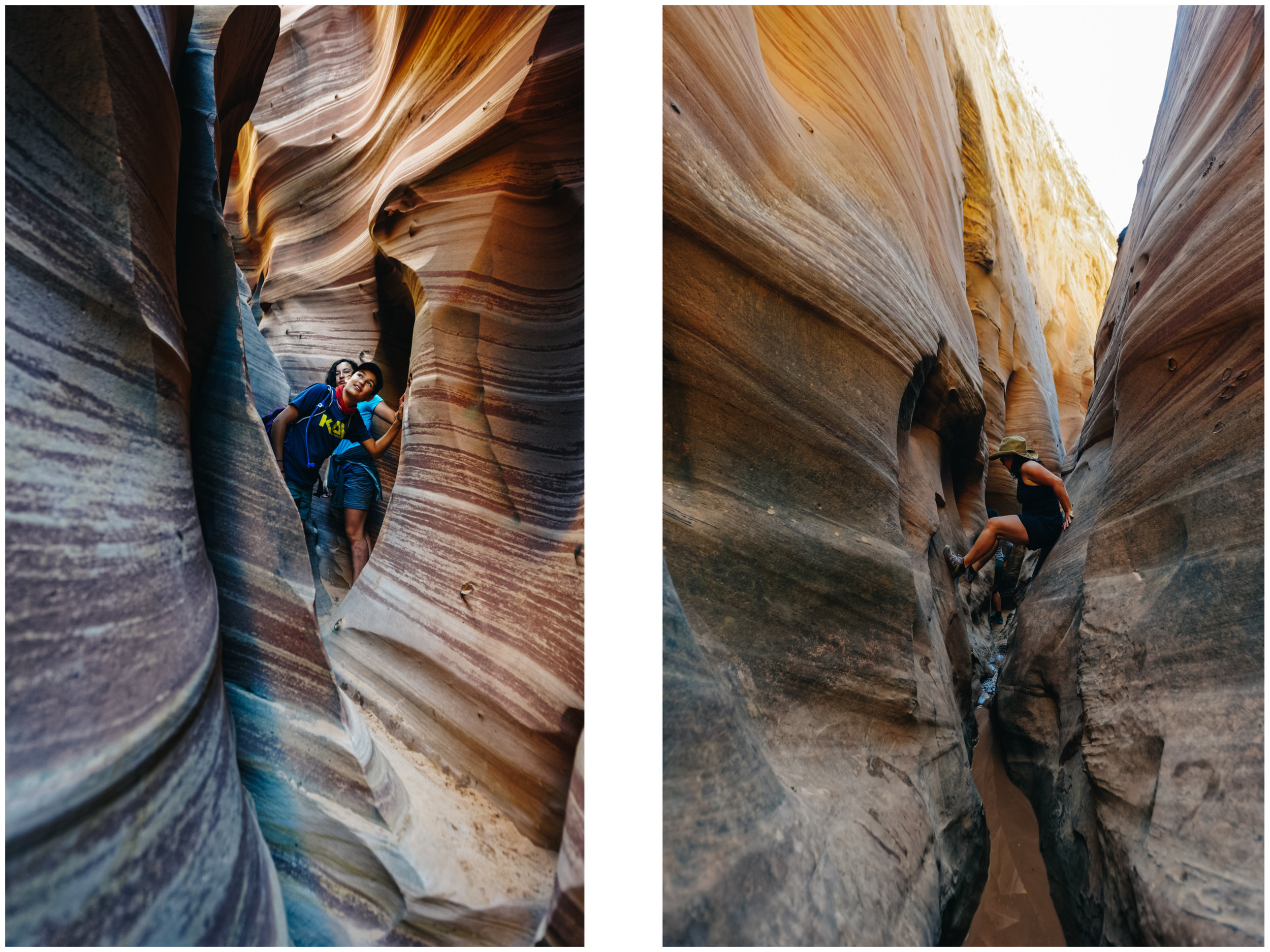
Descending into the canyon

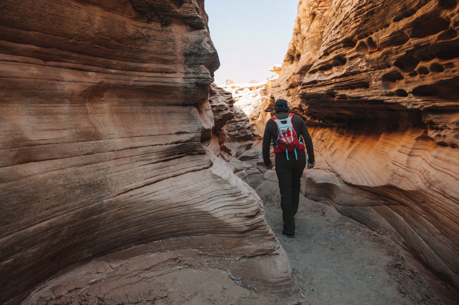
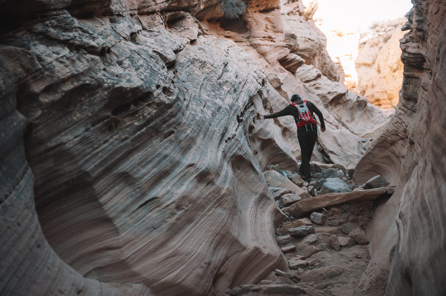
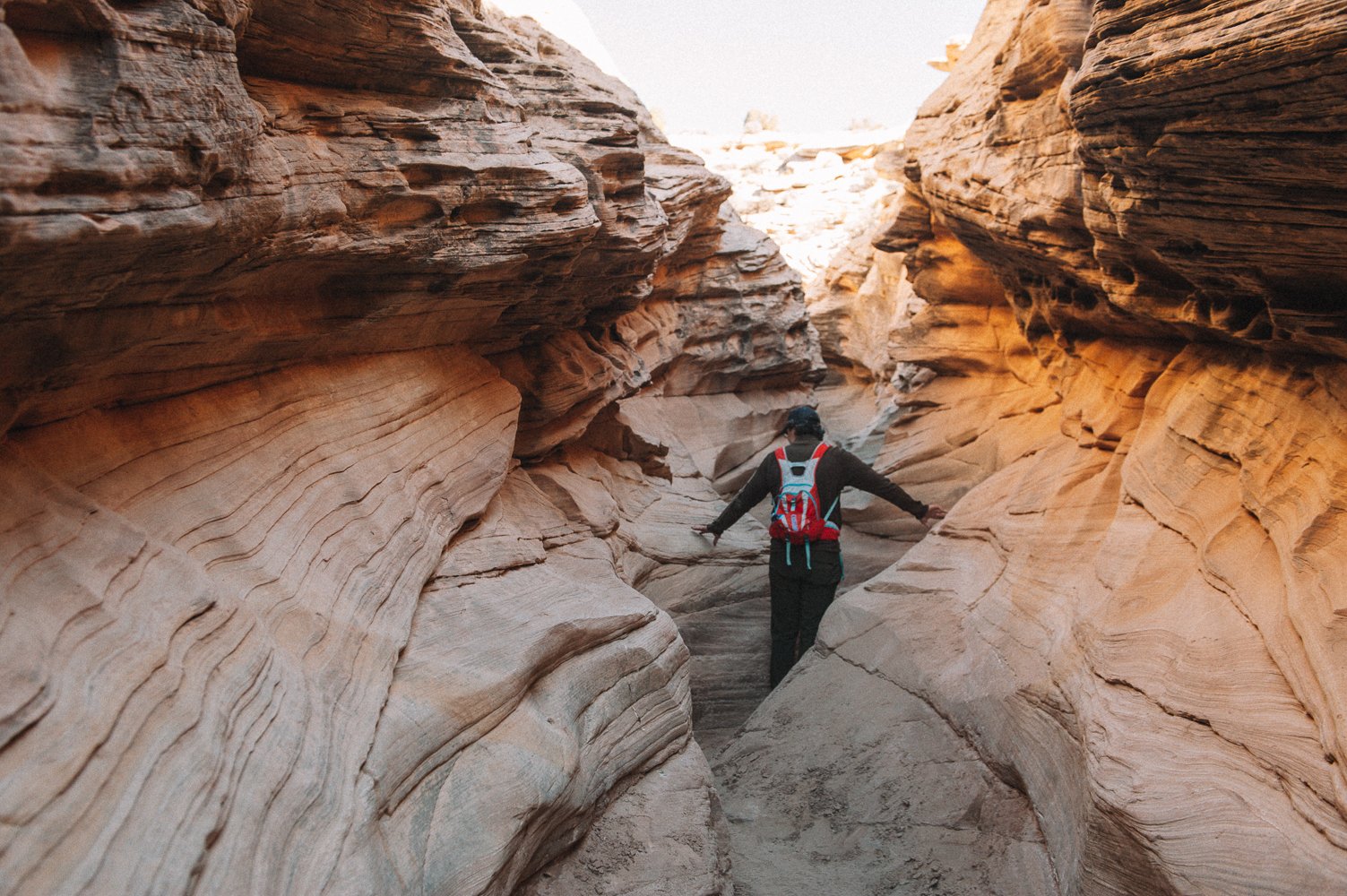
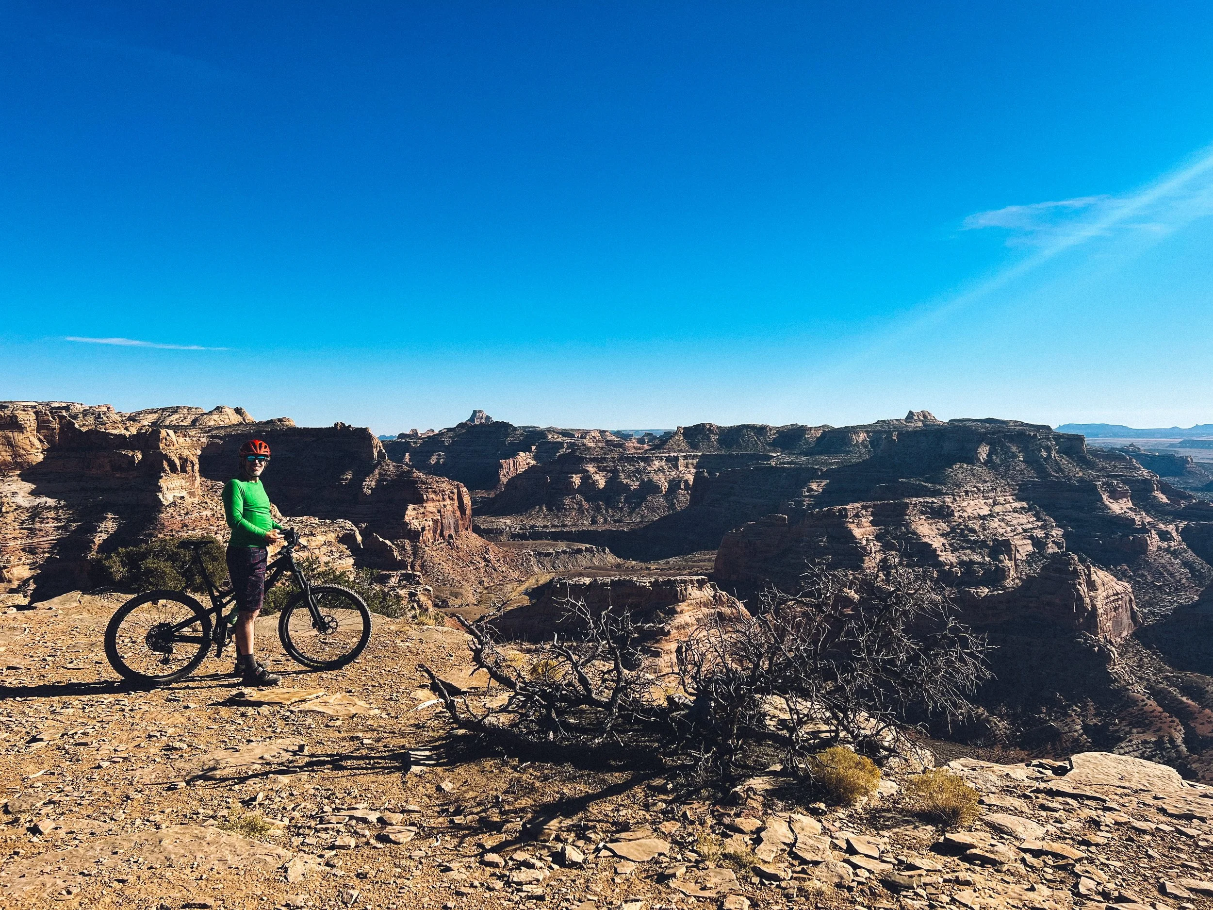
Listening to pure silence

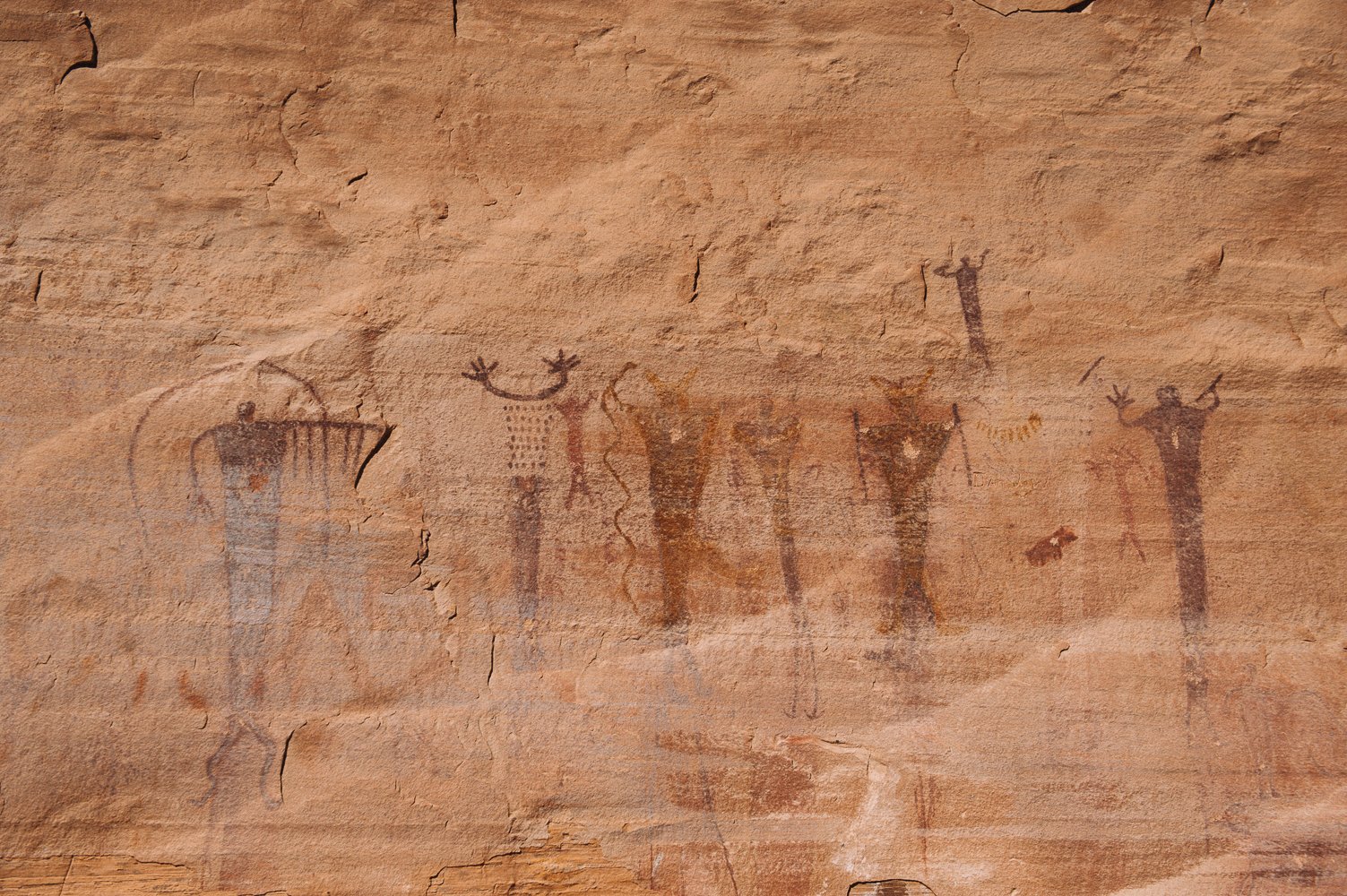
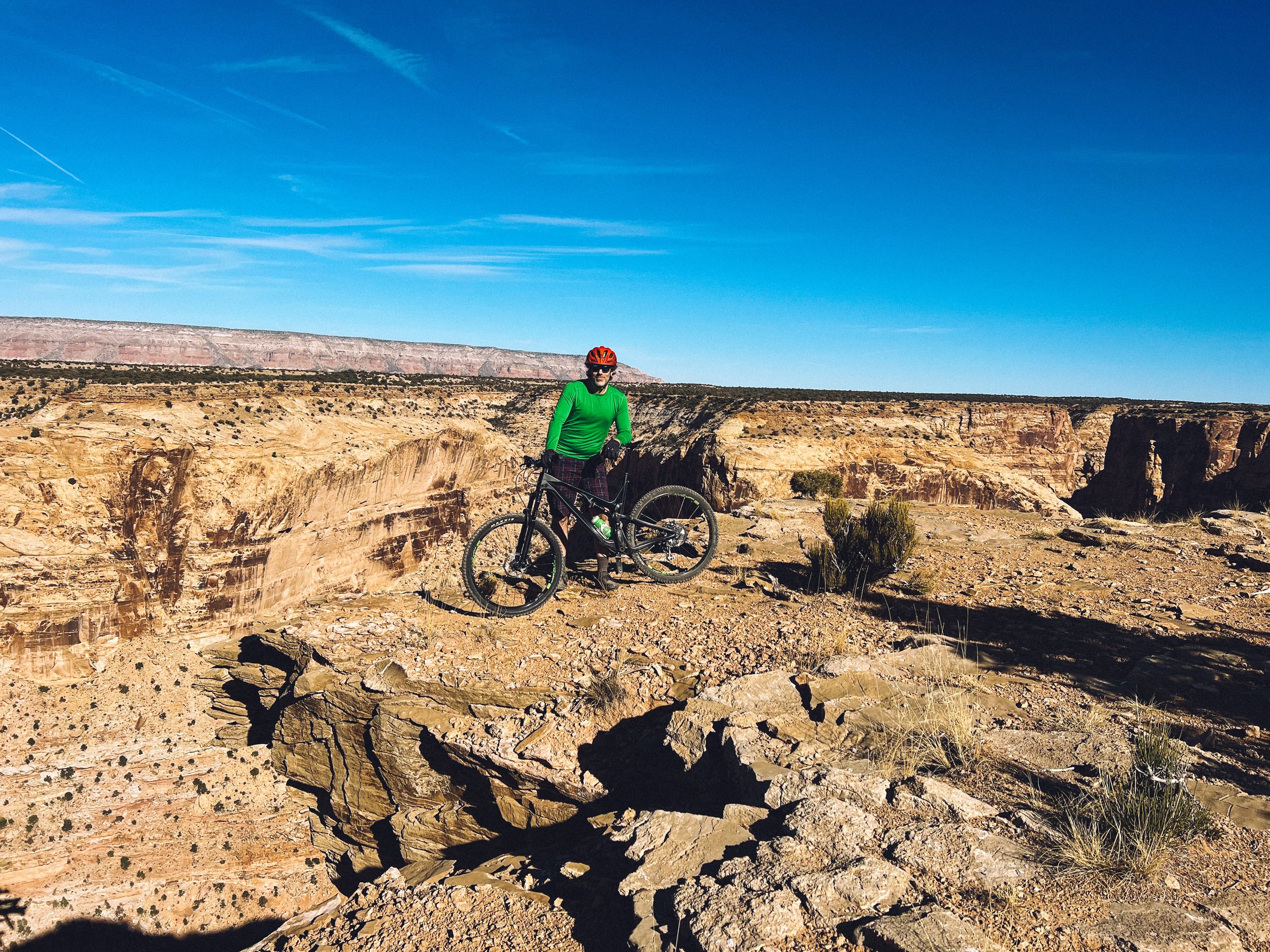
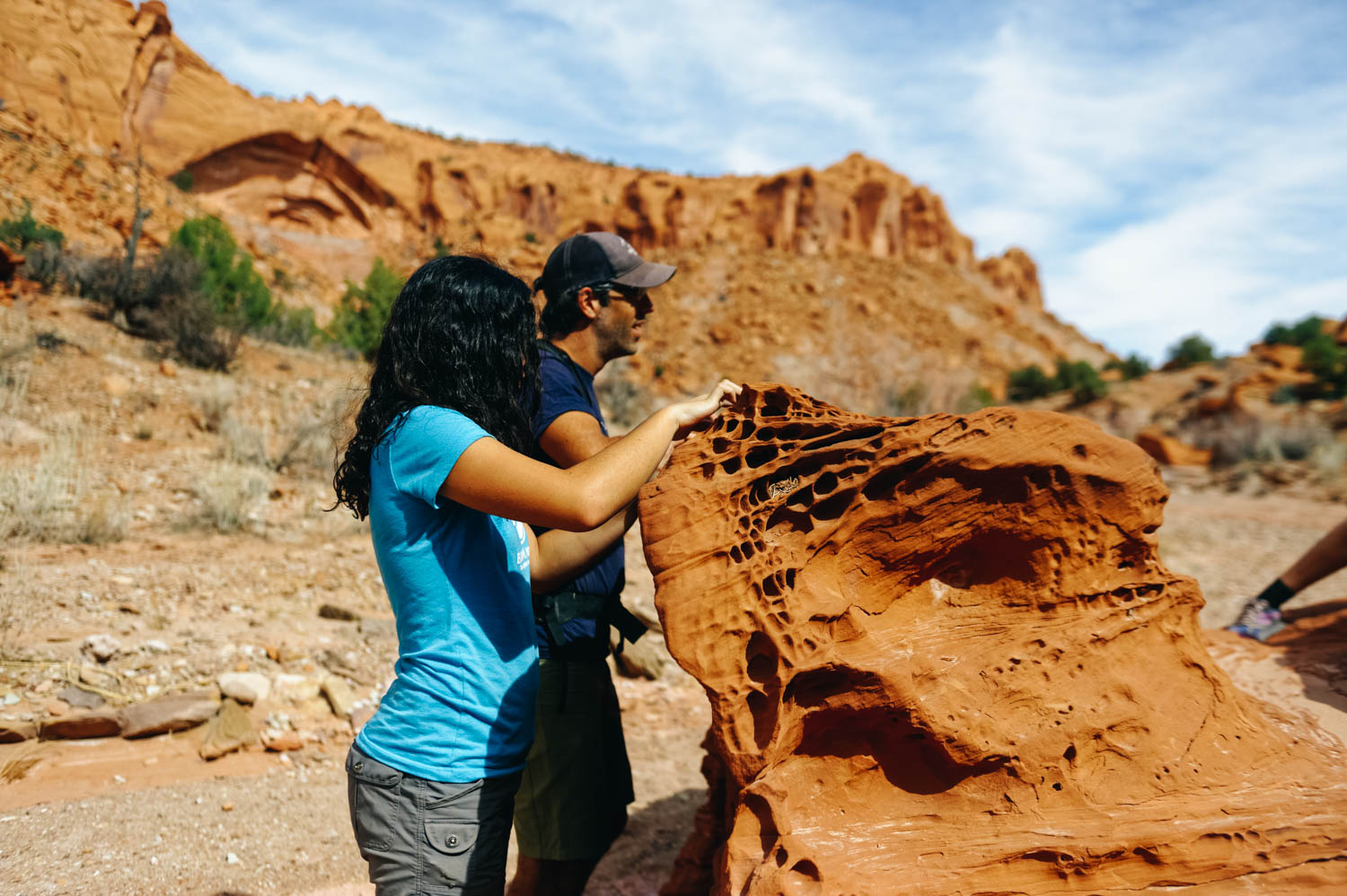
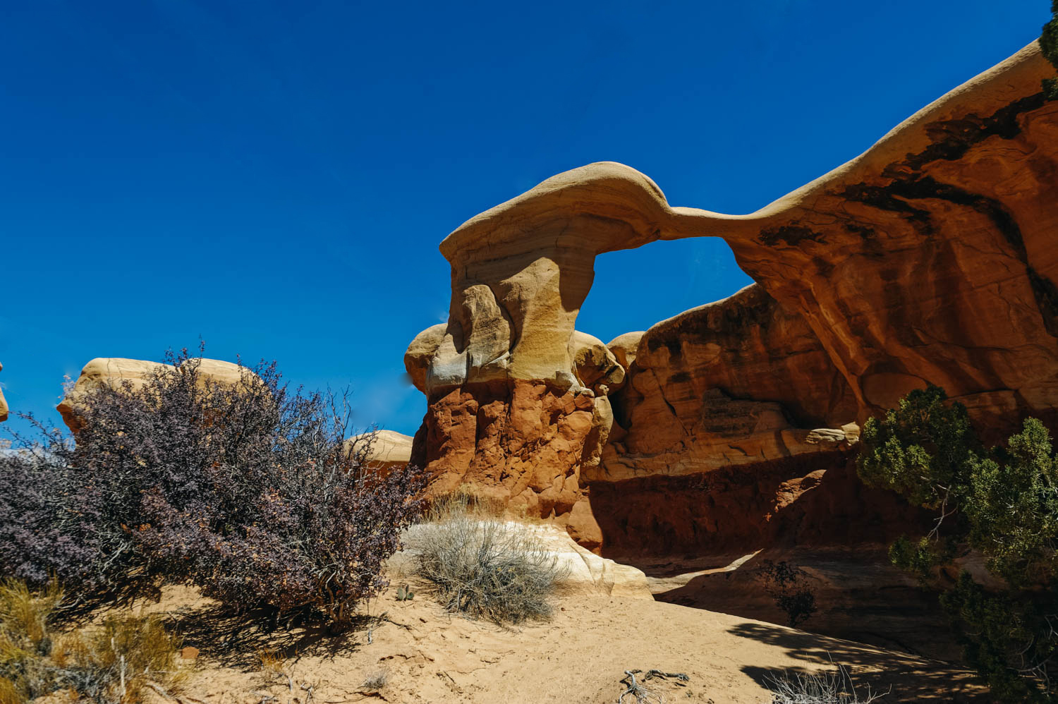
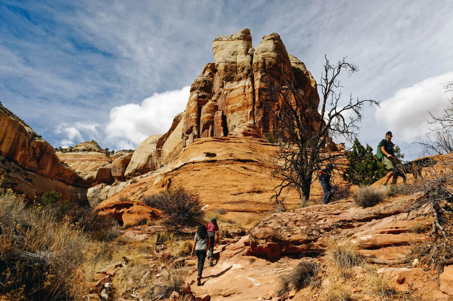
We didn’t see a soul all day. We could not stop shaking our heads as we explored yet another point on the map, each one more spectacular than the last.

It’s a true gem like we’ve rarely seen before.

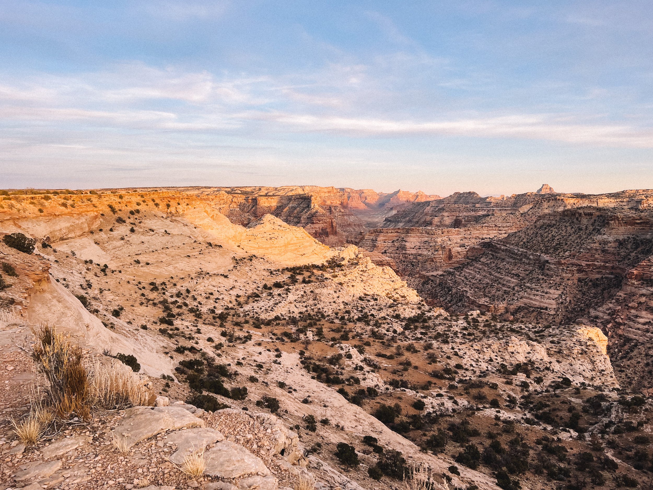
We’re still in awe that places like this still exist. Unspoiled. Let’s keep it this way.


Furniture Draw Canyon and Buckhorn Draw road


This short, flat trail leads you through tall canyon washes. It is not technical at all and includes a few narrow sections. It’s great for all ability levels and shows the area’s beauty in less than four miles.

This canyon is totally kid and pet-friendly. Much of the wash is pretty wide and full of scree. Unlike many other canyons, it’s easy to find and easy to navigate. If you’re used to more  technical slotting, this will be rather underwhelming, but it’s still a beautiful canyon.

The rock formation is very similar to Little Wild Horse Canyon since they are both part of the San Rafael Swell. Furniture Draw is shorter and much less popular (although less stunning).

The whole area totally blew our minds. The Buckhorn Draw road reminded us a bit of the Burr Trail. It is stunningly scenic.

5 km down the road from Furniture Draw, you can see some really well-maintained pictographs and petroglyphs. There are also dinosaur tracks nearby.

The Buckhorn Draw Pictograph panel.

There are tons of gorgeous campsites along the canyon walls of Buckhorn Draw road, but they are $15 per night and the signal is not as good as at The Wedge.


The Wedge and Good Water Rim trail


The Wedge, also called The Little Grand Canyon, is located in Eastern Utah and despite its amazing beauty is relatively unknown. It is on BLM land, 20 miles east of Castle Dale and about three hours from Salt Lake City. 

It’s so special to camp (for free!) right on the rim of this spectacular canyon. We were afraid it was going to be crowded but there was almost no one there. The area is so large that we could not see any other campers from our spot. 

The Good Water Rim bike trail starts and ends here.
It’s a 21,5 mile loop.

This unique trail is a singletrack that parallels the contours of ‘The Wedge’ in the San Rafael Swell. If you do only choose to do a portion of the Good Water Rim Trail, I recommend to ride the west side where the views are more impressive.

The trail hugs the rim most of the way. The views are simply incredible.

Note that the wedge campgrounds are divided into two separate areas. Sites 1-7 fork left as you drive in (we picked site 7B which was huge). These sites generally do not have access to the stunning rim views that most people are after. 
Even though you are not really on the "Little Grand Canyon", Site 1 is gorgeous and remote. It's at the end of the road and has a nice view since it is "perched" on a little outcropping.

View from the East trailhead Overlook. We were completely alone for miles.

I’m sure it gets busier during the shoulder season when the weather is perfect, but I wouldn’t want to be here in the summer as there is no shade. It was pretty cold at night in November, but the days were perfect (for us northerners, at least) to hike and bike. Hey, there’s a reason it’s called the off-season and we had the place to ourselves!

Little Grand Canyon Overlook with the San Rafael River a the bottom.

What we discovered is that the most amazing sites right on the rim are directly AFTER site 9. These are not official BLM spots, but as long as you stay in the boundaries and camp on a designated site that has a fire ring, it is OK.

People with small children or pets might not want to camp on the ledge as there is obviously no fencing whatsoever.

One of the many amazing campsites along the canyon. If you sleepwalk, don’t camp here!

Many spots have been closed off and there is lots of cryptobiotic soil, so stay off and watch your step.

There is no water and no garbage cans, but there are very clean pit toilets at the trailheads and overlooks.

The dirt road is well graded all the way to the campsites. You won’t need a high clearance vehicle to get to them.

It’s pretty high (6,200 feet), so the nights are cold.


Exploring Utah's Canyons part 4: San Rafael Reef

_CFO4433_DxO.jpg
lhc.jpg
_CFO4465_DxO.jpg
Little Wild Horse Canyon is so sinuous, you feel like water walking through it.

Little Wild Horse Canyon is so sinuous, you feel like water walking through it.

Mathilde is always ready to rest. Ahem.

Mathilde is always ready to rest. Ahem.

_CFO4469_DxO.jpg
So, so gorgeous!

So, so gorgeous!

Canyons have been described as sensuous and feminine, womb-like in opposition to mountains and spires or hoodoos. You see, something unique happen when you stand in the belly of the earth. You want to run your fingers along the round walls, like a p…

Canyons have been described as sensuous and feminine, womb-like in opposition to mountains and spires or hoodoos. You see, something unique happen when you stand in the belly of the earth. You want to run your fingers along the round walls, like a pregnant belly or a breast. You want to linger, to drift… you don't want to get out of that embrace, to reemerge  and reenter the world beyond that womb.

lhc6.jpg

In their book Utah Canyon Country, Kathy and Craig Copeland warn the hikers pretty clearly about Bell & Little Wild Horse canyons: The circuit linking the two canyons is a merry-go-round of enthusiastic hikers: kids sprinting away from their ambling parents, young couples lugging babies in backpacks, seniors cautiously shrouded head-to-toe in sun-barrier clothing, experienced trekkers sheepish about participating in such a carnival yet enjoying it too. (…) Hiking here is like joining a hikers’ pride parade. It’s an act of solidarity with your comrades: the people raising hikers-to-be. Not convinced? Then come here simply to marvel at the bizarre beauty of the San Rafael Reef. These canyons are so extraordinary they’ll command your attention while the party swirls on without you.

Little Wild Horse Canyon (2-4 miles round trip to simply explore the first section of LWH Canyon or 9 miles to do the loop hike with Bell Canyon, easy, dog-friendly but lots of people, VERY HEAVY traffic):

There were over 60 vehicles in the parking lot when we arrived at 3 pm on a Monday afternoon (granted, it was during Spring Break, but still!). We decided to go find a camping spot on Little Wild Horse BLM just a few minutes from there and waited for the crowd to leave. We started our hike in the canyon at 6 pm and had the place pretty much to ourselves. It was AMAZING. We hike pretty fast, but we were able to see a lot of Little Wild Horse Canyon and return by 8 pm. It is undeniably the most beautiful slot canyon we have seen when taking in consideration the minimal approach and how easy it is to hike it (no technical challenge at all).

Most people simply walk a few miles into Little Wild Horse Canyon and turn around (like we did), but you can also do it in a loop starting with Bell Canyon and returning through Little Wild Horse Canyon. I believe it would be doable the other way around too (but you might want to double check that in case there are obstacles) in order to avoid the crowd if you start very early from LWH canyon.


Our beautiful (and very windy) campsite on Little Wild Horse BLM.

Our beautiful (and very windy) campsite on Little Wild Horse BLM.


To also check in the same area:

Crack Canyon (7 miles round trip, easy with a few obstacles requiring some gymnastic efforts, dogs allowed, but has to be pretty athletic, moderate to low traffic)

Chute Canyon (4.5 miles round trip, easy, dogs allowed, moderate to low traffic)

I'm not going to keep you from paying $15 to go into Goblin Valley State park and spend an hour (or less) climbing on goblin-like rock formations (why on earth do they allow people to climb on such fragile formations, I don't know...), but if you do and you have bikes, go explore a much less crowded area of the park with really nice easy bike trails and ride The Dark Side of the Moon to get very close to the San Rafael Swell.

Recommended books:

Map (note that there is no cell signal in most of these places, so you'll likely need a paper map) : Canyons of the Escalante

Hiking Grand Staircase-Escalante & the Glen Canyon Region: A Guide To 59 Of The Best Hiking Adventures In Southern Utah

Hiking from Here to Wow: Utah Canyon Country

Hiking the Escalante

Exploring Utah's Canyons part 3: Burr Trail

On the Burr Trail, at about mile 15.

On the Burr Trail, at about mile 15.

Driving the Burr Trail, mile 12.

Driving the Burr Trail, mile 12.

Happy!

Happy!

The Crown, on the Burr Trail. 

The Crown, on the Burr Trail. 

The last time we were here was in the Fall of 2012. We had fallen in love head over heel with this place, but could not come back because of the lack of connexion (needed for our work) and because we thought Route 12 would not be doable with the bus. So this year, for my 40th birthday, we took 2 full weeks off work and came back to our first love. At that time, we had also explored some of the canyons around Kanab (Wire Pass + Buckskin Gulch), The Wave and Waterholes Canyon (near Page, AZ).

We are happy to report that there is now signal in Escalante (and at the BLM on top of Hole-in-the-Rock Road), but still no signal past 5 miles on the Burr Trail (but signal in Boulder).

The entire 68-mile stretch of the Burr Trail Road is scenic and filled with natural beauty. I still think it is one of the US most scenic road. The drive takes you from Boulder through Grand Staircase–Escalante National Monument, all the way to the Notom-Bullfrog road in Capitol Reef National Park.

Hike to Wolverine Canyon.

Hike to Wolverine Canyon.

The petrified wood field on the way to Wolverine Canyon.

The petrified wood field on the way to Wolverine Canyon.

_CFO4367_DxO.jpg
LOTS of cows and calves on the trail at this time of year!

LOTS of cows and calves on the trail at this time of year!

Those wholes in the sandstone are called taffoni. I always feel like Al Pacino when I pronounce it.

Those wholes in the sandstone are called taffoni. I always feel like Al Pacino when I pronounce it.

These boulders are begging to be claimed.

These boulders are begging to be claimed.

There are two giant alcoves in the canyon.

There are two giant alcoves in the canyon.

Driving on Wolverine Rd.

Driving on Wolverine Rd.


Wolverine canyon (3 miles round trip to the petrified wood pile, 5 miles round trip to the narrow section of the canyon, easy, dog-friendly but lots of cows, low traffic): Located on the Wolverine Loop Road, this canyon begins wide and gradually constricts into beautiful sculpted narrows (from 8 to 15 feet, this is not a slot canyon) with huge alcoves (this is where we turned around, for a 5 miles round trip). There is an abundance of petrified wood (I know, I felt I was done with petrified wood, but this is something else…it was set aside by the BLM as an outstanding natural area). The black petrified wood attracts the eye because the purple and lavender hills provide such a vibrant backdrop. The only challenge when we hiked it were the many cows (and brand new calves) along the wash and we needed to give them some space and go off trail.

To also check in the same area:

Little Death Hollow (15.2 miles round trip through Horse Canyon and Wolverine Canyon, moderate to challenging, not dog-friendly, low to moderate traffic): This was closed when we got there because a cow was stuck inside the canyon. Most people do the loop starting at Little Death Hollow trailhead, through Horse Canyon and back up Wolverine Canyon in 2 or 3 days because there are some nice campsites along the trail, or a longer full day hike. Note that Little Death Hollow cannot be done as an in-and-out day hike unless you are a seasoned climber.


Singing Canyon (a canyon just by the road, 11.5 miles down the Burr Trail, dog-friendly): a great stop on the Burr Trail with little ones or just to go explore and break into a tune. This canyon offers spectacular acoustic and you might even see a violinist of flute player while you are there.


Upper Muley Twist (9.4 miles, moderate with some exposure, dogs not allowed, low traffic): Deemed the most beautiful hike in Capitol Reef N.P., this hike has it all: a wash approach, a rim trail and a canyon. Check the weather before going this is a prime spot for lightning strike.


Our beautiful free campsite on the Burr Trail. Not sharing this one ;)

Our beautiful free campsite on the Burr Trail. Not sharing this one ;)

Easter Pizza! That's a thing, right?

Easter Pizza! That's a thing, right?

_CFO4396_DxO.jpg

Exploring Utah's Canyons part 2: Hole-in-the-Rock Road

Approach hike to Big Horn Canyon

Approach hike to Big Horn Canyon

The incredible colors and texture in Big Horn Canyon.

The incredible colors and texture in Big Horn Canyon.

Feeling like we are in another world, alone in Big Horn Canyon.

Feeling like we are in another world, alone in Big Horn Canyon.

Playing in a shallow section of Big Horn Canyon.

Playing in a shallow section of Big Horn Canyon.

Hole-in-the-Rock Road has the biggest concentration of slot canyons in Utah. It is 57 miles one-way and 4 x 4 is strongly recommended for the last 7 miles. There was LOTS of wash board on this route when we were there and driving it in our van wasn't fun. We decided NOT to drive the 50 something mile required to get to some of the canyons we wanted to explore and stuck to the canyons located on the first 15 miles of the road for that reason.

There are no route markers on most canyon trails (sometimes a cairn here and there). You need a map and some navigation skills.

As the Copelands put it in their book: Hiking, particularly when routefinding rather than heedlessly following a trail, reboots our connection with nature. It requires us to engage directly. And canyon country is the ideal place to venture into trail-less terrain.

These places invite exploration, but if you want to veer off the path, you should stay on the cattle trails to avoid destroying the fragile desert crust. Do not add cairns, do not write with mud on the canyon walls, keep your voice down (and teach this to your kids). Enthusiasm is beautiful, but this is not an amusement park. Be respectful of others who are likely to look for a more contemplative experience.

Big Horn canyon (5 miles round trip, easy, dog-friendly, moderate traffic): Big Horn Canyon is an interesting tributary of Harris Wash in a rarely explored part of the Grand Staircase-Escalante National Monument. It was our best *discovery*. The wide range of colors, textures and formations took our breath away. The canyon deepens quickly, eventually reaching a depth of 400 feet, and forms slot-like channels of varying narrowness mixed with wider, flat sections. It has two forks and all could be seen in five hours though adjacent parts of Harris Wash, and especially some of its nearby side canyons, are also worth visiting.

Squeezing through an unnamed side canyon we discovered while hiking in Big Horn Canyon. It led to a beautiful cathedral-like area.

Squeezing through an unnamed side canyon we discovered while hiking in Big Horn Canyon. It led to a beautiful cathedral-like area.

JF using his elbows to slowly get down this steep section of the side canyon.

JF using his elbows to slowly get down this steep section of the side canyon.

We have a tradition to pick a birthday hike (or ride). I had picked Little Death Hollow, but it was closed since a cow was stuck in it and someone else had been charged by an aggressive cow… So back to the drawing board we went and decided to check out Zebra Canyon.

Zebra slot canyon (5 miles round trip, easy to get there/moderate, some stemming required in the canyon, canyon is not dog-friendly, high to moderate traffic): This is a very short slot canyon (200 m) that require some wiggling and stemming to get through. It often contains water and quicksand. When we did it, there was two 50 feet-long sections of mid-calf freezing cold water. The slot canyon is reached after a 2 miles beautiful approach walk down to Harris Wash. There are not route markers here and it can be confusing for many. Make sure you have a map.

The birthday hike crew

The birthday hike crew

Canyons invite exploration

Canyons invite exploration

Walking in the wash to get to Zebra Canyon.

Walking in the wash to get to Zebra Canyon.

Getting closer.

Getting closer.

There was two 50 feet-long sections of mid-calf freezing cold water. I got feet cramps that were so bad I could not stand for a minute.

There was two 50 feet-long sections of mid-calf freezing cold water. I got feet cramps that were so bad I could not stand for a minute.

Mara-give-me-a-challenge Roldan

Mara-give-me-a-challenge Roldan

Being tall is not always a good thing when exploring slot canyons.

Being tall is not always a good thing when exploring slot canyons.

Left: int the narrowest and most beautiful part of Zebra Canyon. Right: JF helps Mara down a steep section.

Left: int the narrowest and most beautiful part of Zebra Canyon. Right: JF helps Mara down a steep section.

Right: looking at a bird's nest in an alcove. Right: me, stemming to avoid a section of freezing water.

Right: looking at a bird's nest in an alcove. Right: me, stemming to avoid a section of freezing water.

_CFO4507.jpg

In many of these canyons, you will see Moqui Marbles. They are sandstone balls cemented by a hard shell of iron oxide minerals. They tumble from the pale, cream-colored navajo sandstone beds, when wind and water wash away the softer rock. The children of the Indian tribe who lived there were known to play with these stones, particularly the smaller stones, and used them like children today use marbles, hence the name Moqui Marbles.

The curious rocks have inspired fantastical tales of fairies, meteorites and dinosaur eggs, but their origin is fairly mundane. Water flowing through sedimentary rock leaves behind minerals that glue together masses of sand, mud or other particles.
Collecting them is prohibited. Please be respectful.

In my research online, I actually discovered that some people are selling them on eBay as shaman stones having special powers. I’m pretty sure this is bad Karma...

To also check in the same area:

Devil’s Garden Hoodoos (stroll around, up to a few miles, perfect natural playground for kids, a few arches and funky hoodoos, 12 miles from Highway 12 on Hole-in-the-Rock road).

Devil's Garden Hoodoos (on Hole-in-the-Rock Road, not to be confused with Arches NP Devil's Garden).

Devil's Garden Hoodoos (on Hole-in-the-Rock Road, not to be confused with Arches NP Devil's Garden).

Metate Arch at Devil's Garden Hoodoos.

Metate Arch at Devil's Garden Hoodoos.

Mara standing on an arch at Devil's Garden. This is an amazing natural playground. You have to stop there if you have kids.

Mara standing on an arch at Devil's Garden. This is an amazing natural playground. You have to stop there if you have kids.

Peekaboo and Spooky Canyons (4.8 miles round trip, moderate, not dog-friendly, heavy traffic): These are undeniably the most visited canyons on Hole-in-the-Rock Road and for good reasons. The approach is short and the experience is unique. However, you might have to wait in line to enter through Peekaboo… it’s that crazy busy. People usually hike up Peekaboo and down Spooky (DO NOT ATTEMPT THIS HIKE IF YOU ARE IN ANY WAY OVERWEIGHT, these canyons are so narrow that people got stuck). Spooky will force even the most slender lanky types to carry their packs over their heads, turn sideways and wiggle through. There are a few chokestones and short drops. If you are #ho shapeshifter, you can also attempt Brimstone Canyon located at the same trailhead (darker and more obstacles, great to check you immunity to claustrophobia). We hiked these almost six years ago with the girls and it was quite the adventure (read the whole story here!)

Neon Canyon and the Golden Cathedral (9.2 miles round trip), moderate, dog-friendly, moderate traffic)

Note that there are many more very interesting canyons to explore on Hole-in-the-Rock Road (Davis Gulch, Llewelyn Gulch, Reflexion Canyon, Willow Gulch, Fortymile Gulch, Egypt 3, Spencer), but many require a 50 mile drive on that often very wash boardy road (it was in very rough shape when we were there).

We camped at this BLM while exploring this area. 


Recommended books:

Map (note that there is no cell signal in most of these places, so you'll likely need a paper map) : Canyons of the Escalante

Hiking Grand Staircase-Escalante & the Glen Canyon Region: A Guide To 59 Of The Best Hiking Adventures In Southern Utah

Hiking from Here to Wow: Utah Canyon Country

Hiking the Escalante

Exploring Utah's Canyons part 1: Skutumpah Road + Lower Calf Creek Falls

Willis Creek

Willis Creek

Willis Creek overarching walls

Willis Creek overarching walls

Wavy walls inside Willis Creek Canyon

Wavy walls inside Willis Creek Canyon

willis4.jpg

When we started traveling around the US 6 years ago, Zion and Bryce National Parks were the new Grand Canyon. Crowds were filling every trail and people that had never hiked in their life showed up on Angel’s Landing trail wearing flip flops and carrying a tiny 250 ml bottle of water they had just bought at the lodge. Now, mainly thanks to social media, Utah’s slot canyons seem to be the new Zion. Whereas we had enjoyed Peekaboo and Spooky Canyons with only a few other adventurous parties 6 years ago, the Escalante Visitor Center ranger told us to stay away from it because there were line-ups of people trying to get in and out. And many of them were not serious hikers, even less slot-canyon savvy.

We knew that Willis Creek slot canyon and Lower Calf Creek Falls would be busy, but we didn’t expect to have people literally crawl under us inside Zebra Canyon (I wish I was joking). It was just ridiculous. Granted it was Spring Break, but we never expected it to be THAT busy.

One of our best experience was at Big Horn Canyon, where we started early and had the place mostly to ourselves until we were on our return. It was also quite special since we *discovered* one of the side slot canyon and ventured inside it not knowing what we would find. It ended in a gorgeous cathedral-like cave. The experience is just not the same at all. Of course, nobody likes busy places, but a crowded slot canyon is just not fun. And can border on dangerous.

Mostly, people are not aware of canyon etiquette. They are loud (and their voice reverberates on the canyon walls and don’t give people space to enjoy the spectacular sections of a canyon. Don’t be these guys. This is not a race, this is an experience. Many are there to have a contemplative experience and don’t feel like chatting. Canyons invite silence and respect.

Here are short description of every canyon we visited (note that there are many more and in other areas of Utah too). These are all accessible from Route 12. To simplify things I have separated them in 4 different posts.

More info can be obtained online or at the Escalante Visitor Center for directions. ALWAYS stop at the nearest visitor center to get information about the state of the trail and the risks of flash floods.

When hiking Willis Creek, we camped on this BLM.

It is easy to get good pictures in Willis creek: the narrow sections are not very long allowing ample light to come in.

It is easy to get good pictures in Willis creek: the narrow sections are not very long allowing ample light to come in.

Willis Creek is very dog-friendly.

Willis Creek is very dog-friendly.

_CFO3982_DxO.jpg

From Cannonville (Skutumpah Rd):

Willis Creek (4.8 miles round trip, easy, very dog-friendly, high traffic): Many slot canyons are accessible only after a 2-3 miles hike in a usually pretty sandy wash (in full sun), but Willis Creek is an exception, which explains why it is so popular. In some books it is describes as the best bang for your buck experience, and I guess it is true if you are in a rush or you want an easy mostly flat hike with no obstacles to climb. However, unless you go very, very early or late in the day, expect to be with a crowd. From the parking lot, the trail quickly drops into the canyon, within 5 minutes, you will see sculpted Navajo sandstone walls rise on both sides. You will go into many sections of slot canyon that alternate with short sections of wash. This explains why it is easy to get good pictures in Willis creek: the narrow sections are not very long allowing ample light to come in. It is a 20 minutes drive down unpaved Skutumpah Road (from Cannonville, on Hwy 12). It is not big-rig accessible (you can leave your rig for the day at the Cannonville Visitor Center or at a nearby BLM).

To also check in the same area:

Lick Wash Canyon (8-mile round trip, easy, dog friendly, moderate traffic). We did it almost 6 years ago and didn't find it particularly interesting.

Hike to Lower Calf Creek Falls

Hike to Lower Calf Creek Falls

Hike to Lower Calf Creek Falls

Hike to Lower Calf Creek Falls

Right on Route 12, between Escalante and Boulder:

Lower Calf Creek falls (6 miles round trip, easy, very dog-friendly, high traffic): Note that this is not a slot canyon, but a hike that leads you along high sandstone walls (with a few petroglyphs) to a beautiful waterfall. The hike in itself is beautiful from the start. It is a great hike to do if slots canyons are vulnerable to flash floods. There are some sandy sections and some ups and downs. In warm weather, people swim in the pool at the bottom of the fall.

Lower Calf Creek Falls.

Lower Calf Creek Falls.