Mary Jane Canyon and some Moab updates

Driving on Ranch rd/BLM 98 to get to Mary Jane Canyon. What a view!

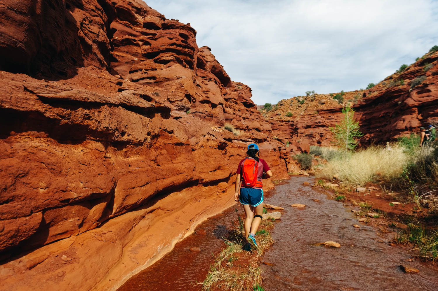
After about 5 minutes of walking on the trail, you have to get your feet wet!

And it just gets better.

The sandstone is so red it's almost purple and when you walk in the water, it looks like there is blood around your feet.
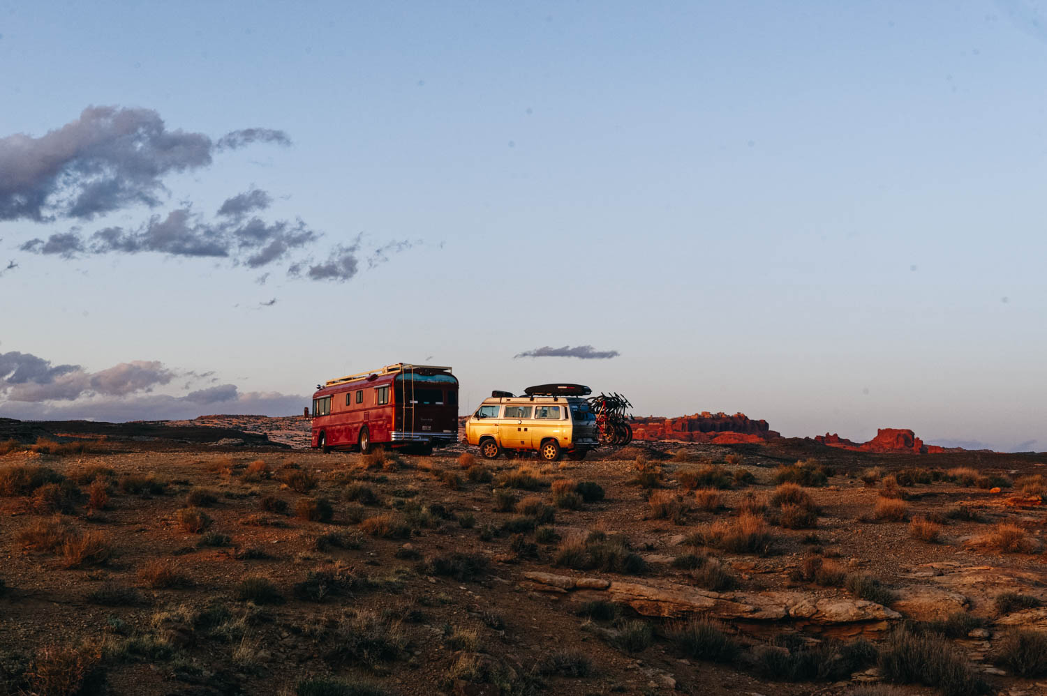
Finally found a quiet camping spot about 25 minutes out of Moab. With a gorgeous view of the Fiery Furnace.
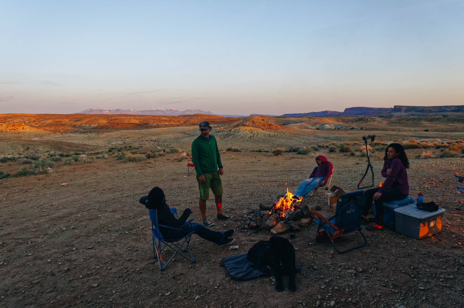
Silence. Finally. After days of constant OHV noise.
If you type Moab on the Home page search bar of the blog, you'll see a ridiculous number of posts pop up. We just love Moab and have been coming here every year for the last 5 years. The more helpful post for bike trails and general info that I wrote is this one and this one contains more photos or trails (all the info is still good, except that the coffee at Bike Fiend was NOT good this year, stick to Moab Coffee Roasters and the good cheap laudromat by the Village Market and Chili Pepper Bike shop is not a Domino Pizza and you are left with very few options for laundry... We ended up going to Moab Laundry (that we call the Gringo Laundromat, because it's pack full with travelers and it's ridiculously cheap and the driers take forever to dry... buuut, it's right by the City Market AND Gearhead (where you can fill your jugs with delicious spring water for free), so we can kill 3 birds with one stone.
Coming here every year for a while also means that we have seen the effects of more and more people camping on the public lands and that every year, we camp a little further away... Last year, we stayed on Dalton Wells Road since Willow Springs Road was packed and this year, after spending a few very noisy days on Dalton Wells with people riding and racing their OHV all day long in front of our bus, we moved further out of town.
There has been lots of discussions on Instagram lately among the vanlifers about the repercussions of sharing the exact coordinates of these free campsites (and other beautiful locations). Many of us feel directly responsible for drawing crowds there (and some of us truly are... I know I am for at least a few spots I first reviewed on Campendium). It’s a complex issue and many of us stand on the fence here. We’re not a select little group who should be the only ones to have access to this information. HOWEVER, as Kerri McHale (@asolojourner) says: “There’s surely enough info already out there to get anyone’s feet wet; even if every single one of us stopped geotagging today. (…) This land is open to everyone, and everyone’s free to explore it. We’re not putting up “no trespassing” signs; were just not putting up neon arrows to the road here”.
Of course, I will keep sharing these special spots with people I know. And I will keep sharing them here on the blog. I receive lots of messages from friends and acquaintances (and readers!) planning trips and never refuse them a piece of advice. However, I know these people and know they will not trash them. “These places are our second homes, our refuges”, as Kerri McHale says. She continues: It’s not good for everyone to crowd onto one pinpoint on a map—it changes the land, even when people *aren’t* trashing it. I’ve talked to many locals lately, who see places they’ve come back to for decades overrun and trashed. I once thought, “I don’t have that many followers…how could I really be affecting this?” But that’s kind of like saying, “I’ll just drop this one coke can on the ground. No one comes around here anyway,” isn’t it?
So if you have read this far, let me share with you here one of Moab's best kept secret: Mary Jane Canyon. When the crowds are invading Arches and Canyonlands National Parks (and Corona Arch trail too now...), there are a few hidden gems that you will likely only have to share with a few other hikers if you are willing to drive a few extra miles (or 20). Last year, I told you about the Fisher Towers (still our favorite hike in the area!) and this year, we discovered Mary Jane Canyon. Unfortunately, we didn't get to go all the way to the end where the true gem is: a beautiful 30 feet high split waterfall INSIDE the slot canyon because we ran out of light. It is a long hike (9 miles/14 km round trip) mostly IN the water, so plan accordingly. It is however perfect on a hot day when the crowds are all at Grandstaff Canyon (aka Morning Glory, aka Negro Bill Canyon) to get their feet wet. Some people have reported being able to keep their feet dry by rock hopping, but it'll be a lot of work (and you'll likely slip and get wet or injure yourself). You CAN be in the water 90% of the time, but you will likely have to be walking in it at least 50% if you follow the trail that meanders in and out of the creek. We don't have Keens, so we simply used our regular sneakers with wool hiking socks and it was perfect. JF did it in his Chaco sandals and said it was not ideal because the sole became abrasive under his feet after a while. If you have weak ankles, brink hiking poles. The water was pretty shallow when we did it at the beginning of April (mostly ankle deep, some spots mid-calf) and cold but not freezing. We called the BLM field office in Moab beforehand since it had rained a few days prior, but they said they do not monitor the water level there, so I guess it is not as likely to get flash floods there. The water level does vary during the year and it is usually dry at the end of the summer.
Once you reach the trail head, make sure you take the right trail. The more obvious one is for Professor/Sylvester Creek, which is NOT where you are going. The trail to Mary Jane Canyon is just across the parking lot by a no camping sign. The best info I found about it is on this blog (with photos of the trail head). The canyon walls get higher as you hike further into the canyon, and eventually will reach upwards of 100 ft. I also read that there are several side canyons that allow for exploring tighter slot canyons.